
The fact that several years have passed without hurricanes should not lead us to lower our guard. Preparation is key to better manage the risks associated with this natural phenomenon, which has a typical season each year, from June to November, for the North Atlantic and Northeast Pacific regions.
* This article was published in Geociencias SURA Journal | Issue 1 | November 2016.
“People need to prepare whether they predict one hurricane or twenty,” says Ph.D. Lixion Ávila, Senior Specialist at the U.S. National Hurricane Center, emphasizing the central point of managing these phenomena: it is necessary to always have an action plan.
The “drought” of this type of event in the region, such as the one experienced in the state of Florida, which was not hit by hurricanes for a period of 10 years between Hurricane Wilma in October 2005 and the passage of Hurricane Matthew in the same month in 2016, should not lead us to lower our guard, since part of our region can be affected at any time by this type of threat.
What is a hurricane?
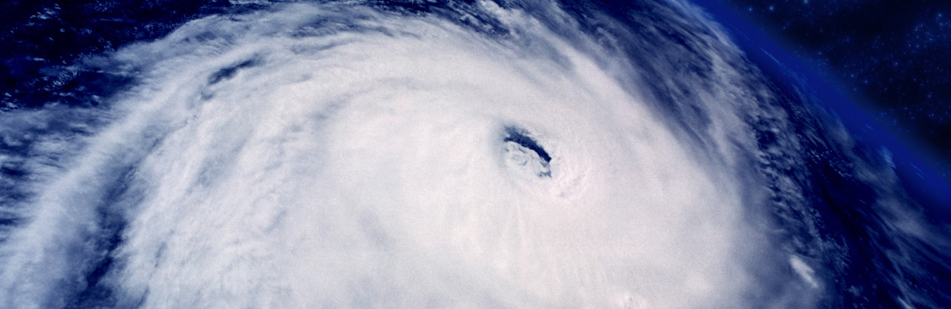
The terms hurricane, depression and storm are associated with a meteorological manifestation called a cyclone. These manifestations are characterized by closed circulation around a warm central core of low pressure, also called an eye. In general, these events occur in the tropics, where the surface waters of the ocean can reach higher temperatures; for this reason they are known as tropical cyclones. They can last for several days and produce secondary effects such as torrential rains and strong waves.
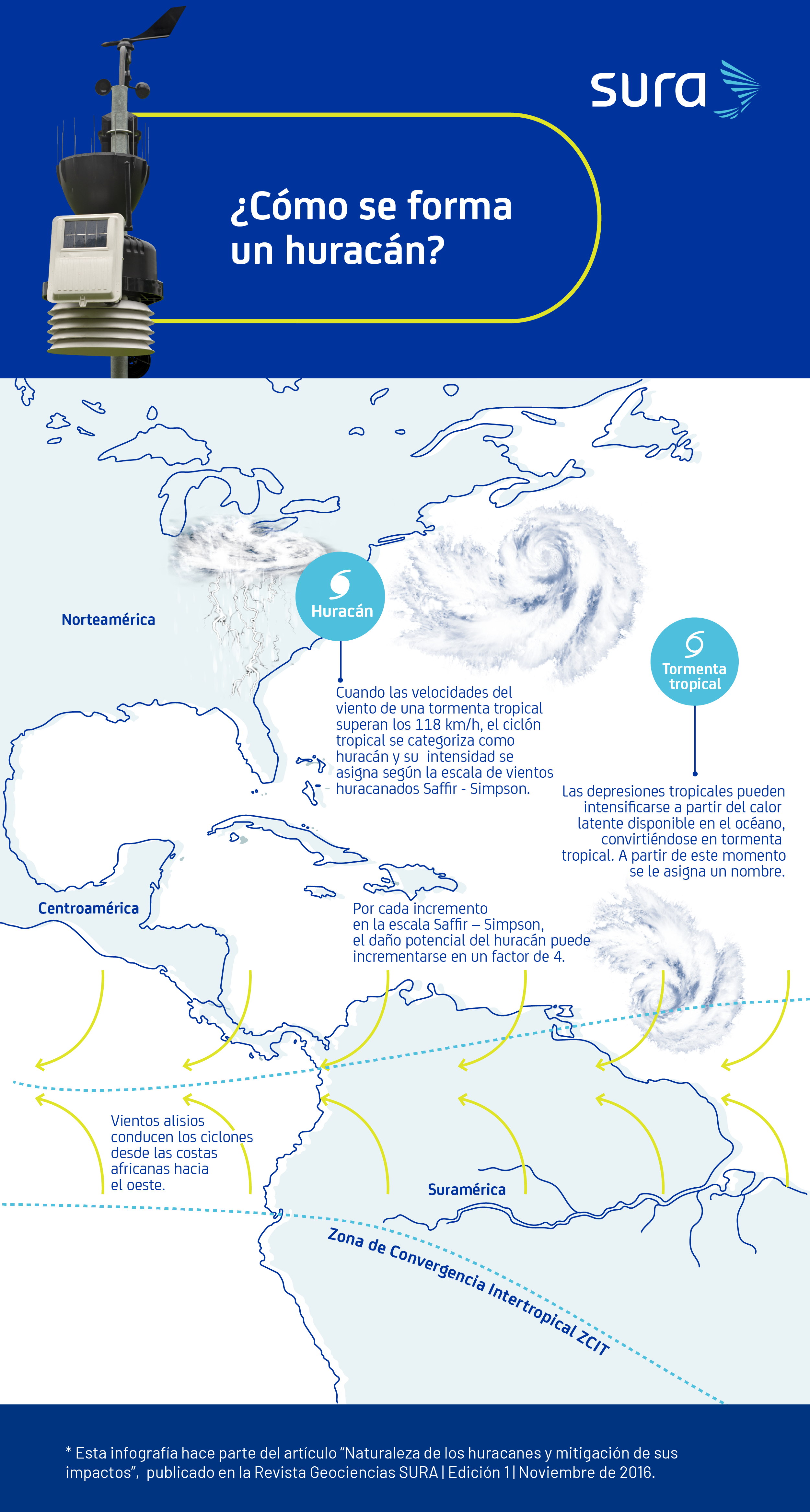
Depending on the area where it occurs, it receives a different name. If it occurs in the North Atlantic basin or in the northeast Pacific, it is called a hurricane. In other areas of the world, such as the eastern Pacific, it is called a typhoon.It is important to note that these names are derived from the native languages of the regions of origin.
The intensity of a cyclone increases as the wind speed increases and the pressure decreases in the central core. It is classified using the Saffir-Simpson scale, which for hurricanes ranges from category 1 (weakest cyclone) to category 5 (strongest cyclone).
Tropical cyclones originate from atmospheric disturbances: a set of several storms in a moisture-laden atmosphere. The disturbances that give rise to most of the hurricanes that affect the Atlantic basin are known as easterly waves, which originate on the African continent due to the contrast between the dry, warm air of the Sahara Desert and the humidity of the Guinea coast.
These storm systems cross the Atlantic Ocean heading west towards the American continent, generating regions of low atmospheric pressure as they pass, when the warm air from the ocean surface rises to great heights, where it cools and subsequently condenses.
Under favorable conditions, these disturbances can intensify and give rise to a tropical depression, which is the initial stage of hurricane formation. For this to occur, the following situations must occur:
- Low atmospheric pressure.
- Average temperature of 26.5°C above the surface layer of the ocean (depths less than 15 meters).
- Weakening of the trade winds.
In general terms, when the average ocean surface temperature is around 26.5°C, heat is transferred to the atmosphere through an increase in the evaporation rate. When this transfer of energy between the ocean and the atmosphere occurs during the passage of an atmospheric disturbance in the Atlantic, the low pressures associated with this system decrease even further and it is at this point that the process of formation of a tropical depression begins: air moves from high pressure areas to low pressure areas.
This flow, affected by the rotational movement of the Earth, enables the circulation mechanism of the air mass that begins to organize itself in the form of a spiral around the center of low pressure.. Based on this process, and depending on the availability of heat energy in the ocean, these systems, which convert heat into mechanical energy, can intensify until they reach their maximum category.
Why monitor a hurricane?
Ph.D. Lixion Ávila explains that the National Hurricane Center is part of the United States Meteorological Service, and is delegated by the World Meteorological Organization (WMO) to issue all tropical cyclone warnings, from Africa to near Hawaii, including the Caribbean islands.
The main mission of this entity is to protect the integrity of people, mitigate damage and improve economic efficiency through:
- Issuance of alerts and forecasts.
- Analysis of severe tropical weather conditions.
- Advances in the knowledge of these phenomena.
There is a tropical cyclone alert and monitoring system coordinated by the United States National Hurricane Center and to which the meteorological services of other countries belong.
There are different tools for monitoring hurricane formation and development:
- Monitoring system of buoys or floating stations with instruments for measuring atmospheric and oceanic variables.
- Hurricane hunter aircraft, whose mission is to fly over the hot central core, perform visual inspection and collect meteorological data.
- Permanent satellite monitoring of atmospheric conditions.
- Ground observers who collect and analyze information from meteorological stations located on continental and island soils.
How to forecast a hurricane?
Weather conditions cause a hurricane season to occur every year, typically between June 1 and November 30, which primarily impacts countries in Central America and the Caribbean. Between these dates, the warm season (summer) begins for the northern hemisphere and, in turn, the easterly winds on the surface begin to weaken, creating conditions suitable for the formation of cyclones.
In order to make forecasts of hurricane tracks and intensities, the National Hurricane Center of the United States uses more than thirty models that vary widely in their level of complexity and structure, which are classified as follows:
- Numerical or physical models: they forecast the trajectories and intensities of hurricanes based on the mathematical solution of the physical equations that represent the movement of the atmosphere.
- Statistical models: These are based on the relationship between historical storms and some specific details of a particular storm, without considering atmospheric physics.
- Statistical-dynamic models: allow forecasting based on the behaviour of a given storm and the physical variables of the environment obtained from dynamic models.
From these types of models, it is possible to make two types of forecasts:
- Seasonal: Prepared annually, before the start of the season, with historical storm data such as intensities in terms of category, pressure, wind speed and trajectories according to ocean conditions and macroclimatic phenomena.
- Operational: It begins when the atmospheric disturbance forms and provides information as it evolves. It provides a three-day forecast that is updated daily, showing the trajectory and intensity of the winds.
On forecasts, Ph.D. Lixion Ávila explains: “Technological developments applied to research have advanced significantly in the last 30 years. Twenty years ago we issued a three-day forecast and it could have an average error in the hurricane’s path of 20 km. Today, the average error of a forecast is 480 km or less.”
What are the risks and threats of a hurricane?
Cyclones are associated with threats of wind, storm surge and torrential rain.
WindsIn addition to strong winds that can exceed 250 km/h, hurricanes and tropical storms can produce tornadoes that form far from the core of the cyclone.
storm surge: is an abnormal increase in waves generated by a tropical cyclone.
Torrential rains:The rain bands of these systems can generate accumulated rainfall of up to 1000 mm in one day, which can cause flooding.
Suramericana is currently implementing an alert service for clients with facilities located in areas with a high potential for hurricane impact. It includes specific and detailed information on weather forecasts according to the region where they are located, based on bulletins issued by the United States National Hurricane Center and other official research and monitoring entities.
Regarding the precautions that should be taken against threats associated with tropical cyclones, Ph.D. Lixion Ávila comments: “The recommendation that we make to the communities in our area is that, Before the season begins, the action plan defined by the respective authorities in case of a hurricane must be reviewed, which varies from one area to another.".
The actions to be taken are not the same in a place prone to flooding, on an island with low topographic relief or on one with high relief, which is why it is recommended to be continuously attentive to the warnings issued by the meteorological services of each country.
The management of this type of risk must go beyond the scope of life protection to the scope of property protection, business continuity and resilience.a. This management includes:
- Identification and quantification of direct and associated threats to this phenomenon, such as winds, torrential rains and storm surges, in the areas of interest.
- Assessment of the vulnerability of people, assets, productive systems and vital infrastructure.
- Prioritisation based on monetary quantification of the aspects that control the management of risks associated with these phenomena from different perspectives - social, business and governmental - and which include aspects such as the health and safety of people, the operation of infrastructure essential to the supply of goods and services, the continuity of production processes and the provision of goods and services, which integrally lead to the sustainability of economic development.
How are hurricanes named?
Ph.D. Lixion Ávila explains that the names are selected based on a consensus at the World Meteorological Organization, whose permanent headquarters are in Geneva, Switzerland. This organization establishes a list of names for possible events that will occur in the next six years, using the three main languages in the region: Spanish, English and French. For each annual season, names are assigned in alphabetical order, as the events occur.
Traditionally, names assigned to hurricanes were feminine, however, since 1979, both feminine and masculine names have been adopted. The names of hurricanes that have caused the most destruction are not included in future lists of possible events.
Fonts
- Lixion Ávila. Senior hurricane specialist at the National Oceanic and Atmospheric Administration (NOAA) National Hurricane Center. M.Sc. and Ph.D. in Atmospheric Sciences from the University of Miami.
- References. Philip JW Klotzbach. Department of Atmospheric Science Colorado State University (www.tropical.colostate.edu).